|
Finding the 3-Mile Point
on the Trail to Lost Palms Oasis |
|
These are instructions for finding the point on the trail from
Cottonwood Spring to the Lost Palms Oasis in Joshua Tree National Park
where the 3-mile marker should be. This point is used to locate the
spot where Jason Lamport's ashes were
scattered.
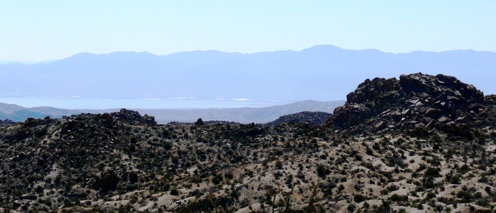
Use the 1- and 2-mile markers to estimate your hiking speed, so you can tell by your watch when you are getting close to the 3-mile point. About 1/4 mile past the 2-mile marker, the trail descends into a long wash and follows it and then crosses another wash. It then begins a steady, gradual climb. About .2 miles before the 3-mile point, you will be able to see the Salton Sea behind you to the right. As you go over a slight rise, you will see this view of the Salton Sea. |
|
|
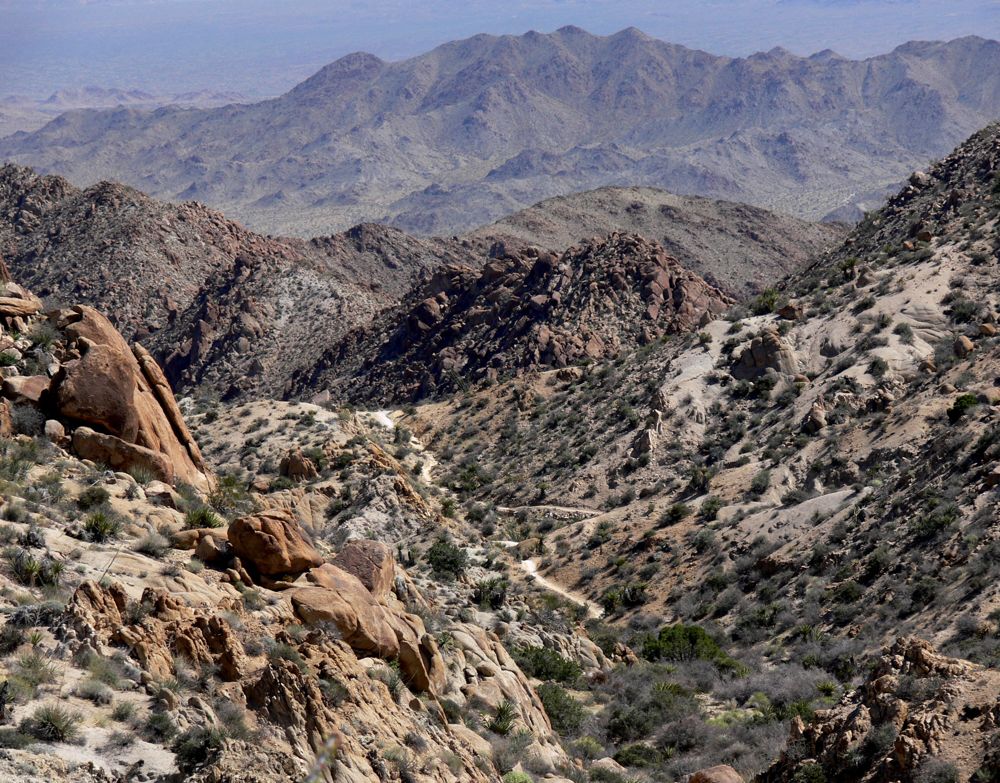
| The trail flattens out and you very briefly lose sight of the Salton Sea. You are then about 30 yeards from the 3-mile point. As you approach the 3-mile point, you will see in the distance this view of the trail ahead, slightly to the right, and below you. (If you find yourself descending somewhat steeply, you have passed the 3-mile point.) |
|
| When you can see this view of the trail in the distance, climb to the top of the ridge on your left. To the north, you should be able to see the rock formation with the bone-like knob. Follow the directions from that point that you will find by clicking here. |